More Ironmask Hills, Trails, and Ponds
Although we have been quietly hiking through the Pineview, Coal Hill and Ironmask Trails for over 40 years, the area has filled with biking (multi-use) trails over the last few years thanks to the ongoing efforts of the Kamloops Bike Riders Association. More access to the Ironmask Hills has been expanded, with new trails going over the southern Ironmask Hill and beyond past Nelson Lake and Galaxy Lake to connect to the upper end of the Pineview Trails via the Marsh Mellow Trail (see the Trailforks map).
On a sunny mild November day I hiked through the area, going over hills, around ponds, up through gullies, winding through the forest, and generally investigating natural and historical features.

A single track trail (Dragonfly) branches and Marsh Mellow leads around the hills over to Nelson Lake, which is really just a large pond.

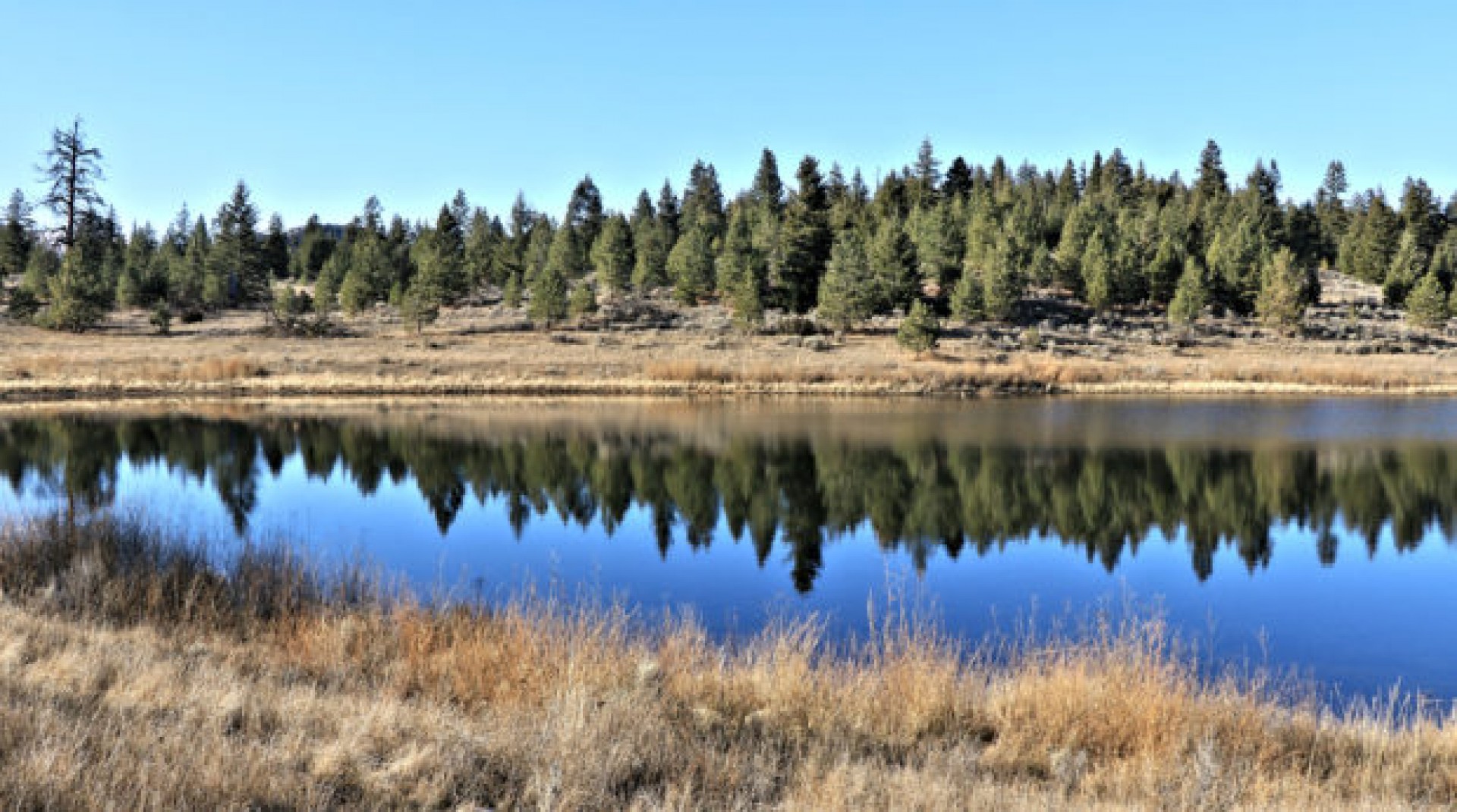
Nelson Lake is surrounded by grasslands slopes and big sagebrush while ponderosa pine and Douglas fir cover the hills above.

An old double track goes up the west side of the pond but I went around the east side to enjoy the reflections in the water.

Continuing east the trail goes past Galaxy Lake. The Galaxy Mine stood above the shoreline and tailings are still obvious above the small pond. When I first came in here 41 years ago there was no fence around the site. There was a tower for the working elevator system. Narrow gauge cars ran into the mine, were filled with excavated materials, then were lifted to the surface where spoil was dumped. The tower and lift device is now long gone now and only a fenced hole and few remnants remain. There is another fenced pit to the north.

A few rails still lie on wooden supports by the edge of the old mine.

narrow gauge rails from the mine
I found an old low-res print photo of myself walking the beam in front of the elevator tower.

From Galaxy Lake I went directly over hills to the top of the southernmost Ironmask Hill for wider views of the area. To the northeast are a series of forested hills.

To the west, on the other side of Lac le Jeune Road, Sugarloaf Hill rises above the plateau.

west to Sugarloaf
The west side of the (Bare Knuckles) hill is very rough so a loop to the south is a better choice, following single tracks like Snagglepuss and Wally’s World.

I visited the remains of an old homestead near a marshy area north of Wallender Lake on the way back

The loop route I took was about 6.5 km, but if you only follow the bike trails which wind around the hills, it will be longer. We will be back to snowshoe the trails this winter.
Doug Smith
Doug writes for Kamloops Trails, a not-for-profit (and ad free) website, offering information on trails, waterways, routes, featured spots, viewpoints, and explorations in the outdoors in the Kamloops area (and beyond).
Doug started exploring this area in 1976 and continues to follow tracks and routes wherever they lead, with the aid of map, compass, GPSr and camera. After many dead-ends, but also many discoveries, he chose to share this information.
The Kamloops Trails website has a massive number of interesting posts and would be of interest to anyone in Kamloops who enjoys the outdoors. Visit the Kamloops Trails website at: http://www.kamloopstrails.net/
My Blog Posts