Brookmere – Brodie – Coldwater in the Snow
We planned to hike the TransCanada Trail from Brookmere to Brodie, then north along the Clearwater River for a day in October but we didn’t anticipate an early area snowfall. It had snowed lightly in the hills near Kamloops but we had not planned to hike in higher elevations so we were surprised by 6″ (15 cm) of snow in Brookmere. We had hiked this route before so we just broke trail along the whole route.

We parked right at the edge of the TransCanada Trail near the old Kettle Valley Railway water tower.

Brookmere is a hamlet on the old Kettle Valley Railway. There was a train station there, a hotel, a school, and a few homes. Many were lost to fire or just abandoned, but a few older buildings still stand.

We trudged down the trail through the snow through in the middle of Brookmere.

The trail bears west following the creek valley (Brook Creek) as it works its way through marshes and forest down to the Coldwater River. We hiked along this trail for 7.1 km (a posted sign says its 6.4 km, but its longer). TransCanada Trail signs were posted at the intersections.

As we came above the Coldwater River, we could see one of the tresses across the river below.

The trail crosses the river at Brodie, a former train station nicknamed The Forks. The Kettle Valley Railway crossed the river on a tress bearing south, following the Coldwater River to the Coquihalla Summit area, then continued past Coquihalla Lake to Coquihalla Canyon. The tress (south fork) across the river going south is no longer standing although the support pillars are still visible on the shoreline. The north tress into Brodie Station is still standing and we walked across it to the west side of the Coldwater River.
This spot was where a spur line went north to Merritt (called the Merritt Subdivision) and then west to Spences Bridge, a link to the CPR line. Freight and passengers from the Interior going to the Fraser Valley and the Coast took the south fork. Freight and passengers going to the CPR line left the Kettle Valley line onto a siding at Brodie.

Brodie
We hiked along the Merritt Subdivision railbed north. There are 7 tresses across the river along the 6.8 km route.

We try to do this hike in the fall when there are fall colors along the Coldwater River.

This is a lovely hike in any month though. The route is 13.8 km and takes about 4 hours. We used a two-vehicle system dropping a vehicle where the trail intersects the Brookmere Road. To do a full loop would add an extra 6 km back up to Brookmere. We have done this route a few times and more information can be found in past articles.

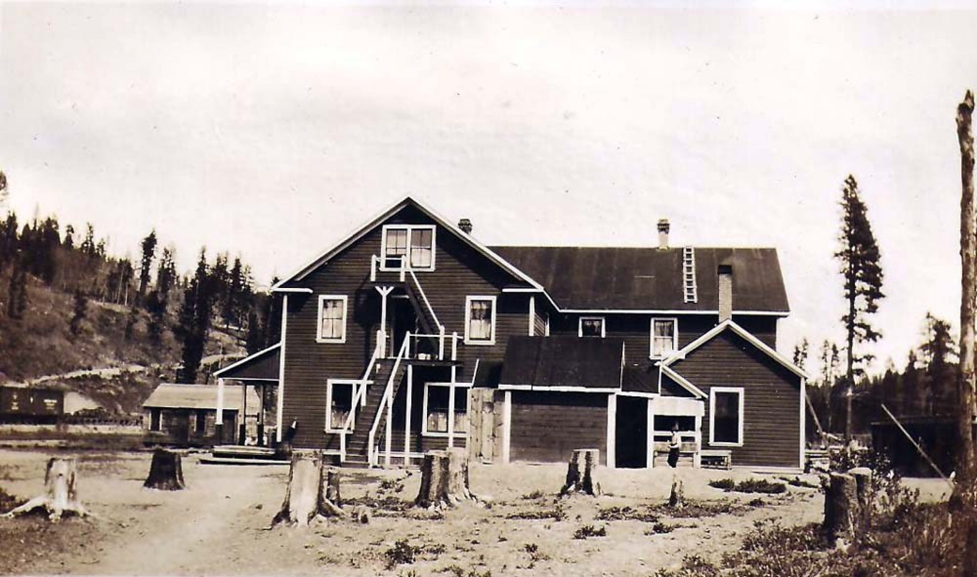
Brookmere Station in 1919
Doug Smith
Doug writes for Kamloops Trails, a not-for-profit (and ad free) website, offering information on trails, waterways, routes, featured spots, viewpoints, and explorations in the outdoors in the Kamloops area (and beyond).
Doug started exploring this area in 1976 and continues to follow tracks and routes wherever they lead, with the aid of map, compass, GPSr and camera. After many dead-ends, but also many discoveries, he chose to share this information.
The Kamloops Trails website has a massive number of interesting posts and would be of interest to anyone in Kamloops who enjoys the outdoors. Visit the Kamloops Trails website at: http://www.kamloopstrails.net/
My Blog Posts